Project: Maritime traffic anomaly detection
Description

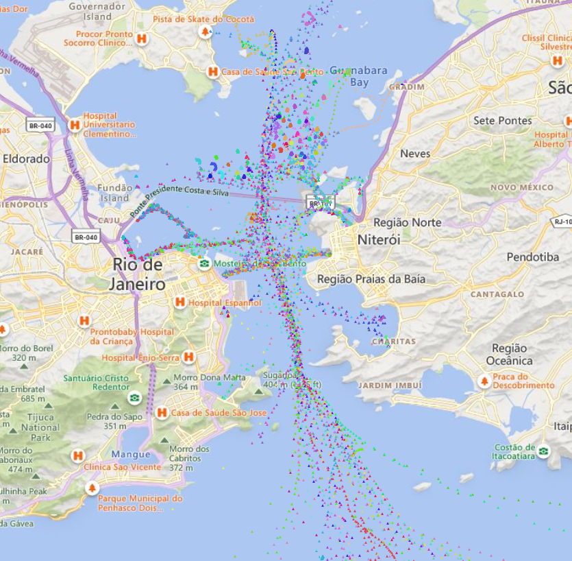
Coastal surveillance systems rely on multiple sensors to perform object assessment [1], i.e., to detect and track the sequence of vessels' states including their position and velocity (where are the vessels at a given timestamp?). In general, surface radars are employed as a primary all-weather, day-night sensor to detect all ships in their range. On the other hand, cooperative vessels often report their position and identity using an Automatic Identification System (AIS) [2] transponder through a TDMA network such that nearby AIS base stations can effectively monitor their trajectories within important areas such as congested harbors and waterways. In this project, we'll explore how to employ the reported vessel trajectories to perform situational assessment [1] (what are the vessels doing?). Specifically, the goal of this project is to employ historical AIS data (see the figure) comprising all recorded ship trajectories within the Guanabara bay in Rio de Janeiro, Brazil over a year to identify patterns-of-life [3,4] and, ultimately, to detect abnormal events / trajectories corresponding to e.g. illicit activities, hazards to navigation, etc.
References:
[1] Steinberg, A. N. and Bowman, C.L., "Rethinking the JDL data fusion levels," Nssdf Jhapl, vol. 38, pp.39, 2004.
[2] Marine Traffic https://www.marinetraffic.com/ (accessed August 6th, 2024).
[3] Riveiro, M., Pallotta, G. and Vespe, M., "Maritime anomaly detection: A review," Wiley Interdisciplinary Reviews: Data Mining and Knowledge Discovery, vol. 8, no.5, pp. e1266, 2018.
[4] Ribeiro, C.V., Paes, A. and de Oliveira, D., "AIS-based maritime anomaly traffic detection: A review," Expert Systems with Applications, vol. 231, pp.120561, 2023.
Details
- Supervisor
-
 Mykola Pechenizkiy
- Secondary supervisor
-
 Stiven Schwanz Dias
- Interested?
- Get in contact